The tech behind
ground truth.

From the flight to the decision.

The world first end-to-end physical Ai in nature
Measure nature from the inside.

We capture the ground, turn it into measurements and insights, and put them in an application your team works in.
Autonomous Capture
Nature
AI Model
Your
Applications
How it works

Three parts. One system.

01

The Capture Kit

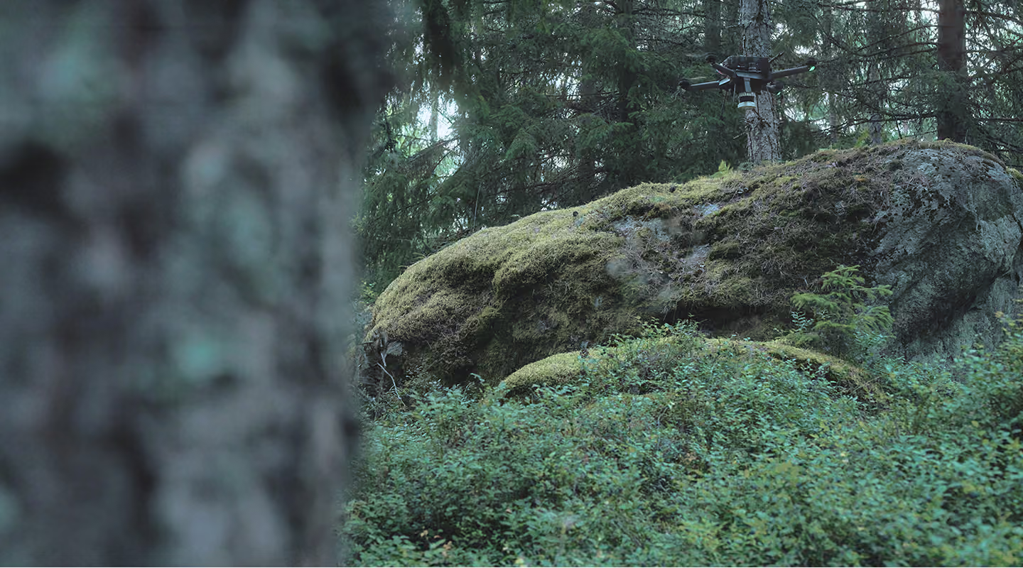
A drone fitted with Neuron Edge™, Deep Forestry's proprietary payload unit that scans and flies the drone by itself between the trees. Your own team or a local partner runs the survey. Where flying doesn't make sense, the same unit is walked as a backpack.

On EDGE
Near Ground Autonomy
Precision Sensor Fusion
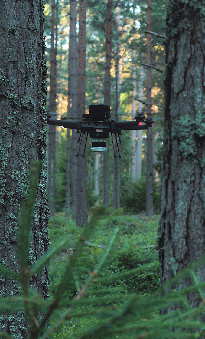
Deep Forestry drone flying autonomously between tree trunks below the forest canopy
02

The Platform

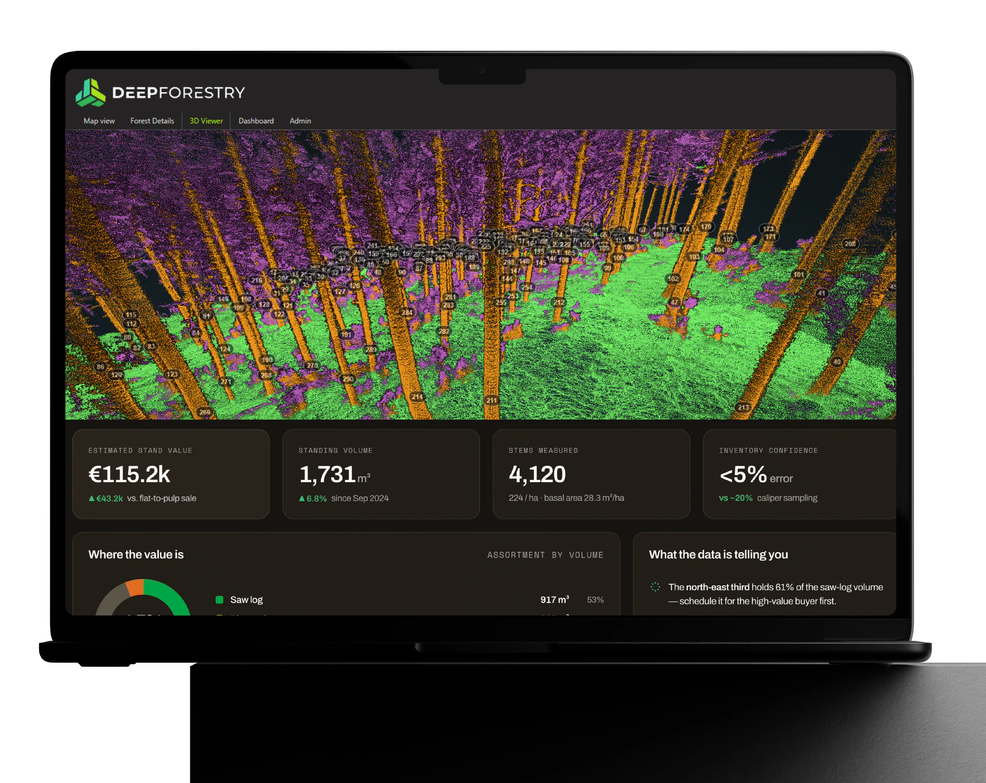
Upload the scan and Neuron Mind™, our own AI, finds every tree in it and measures it: position, height, diameter up the stem, volume. Each number keeps a trail back to its scan. Scan the same area again and every tree is matched to its last visit, building a timeline of how the forest grows and changes.

On CLOUD
Perception
Multi-Modal Measurement
Core Physical AI Framework
Customised Customer AI Model
Deep Forestry portal on a laptop: 3D LiDAR view of measured trees with stand value, standing volume and stem count
Why it needs to exist

Put the sensor where the trunks are.

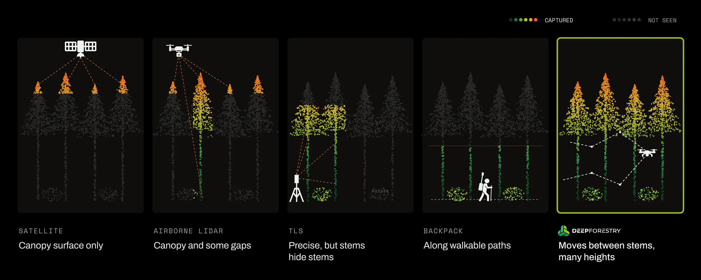
What a forest is worth sits under the leaves: the stems, their size, their shape. Every other method sees part of it and estimates the rest.

Comparison of forest sensing methods: satellite sees canopy only, airborne LiDAR canopy and gaps, TLS hides stems, backpack follows walkable paths, Deep Forestry drone moves between stems at many heights

Everyone else owns a layer.
We own the chain.

Drone makers
Scanner & SLAM makers
Satellite & EO analytics
GIS & geo software
Autonomy without GPS
—
—
Sensing hardware
—
Perception
—
Per-object measurement
—
—
4D model and platform
—
Customer-owned model
—
—
—
—
Fully coveredPartly coveredNot at all

Works with what you run

Your data, in the systems you already use.

Every survey arrives in open formats, not a file only we can open. Connect by API, ask it from your AI assistant through MCP, or download the files. Either way it lands in your GIS, your planning tools and your reporting the day it is processed.

  • MCP
  • API
  • GeoJSON
  • GeoTIFF
  • LAS
  • CSV
  • ArcGIS
  • QGIS
  • Google Earth
  • Sentinel
  • Planet
  • Your ERP
  • Your planning tool

Ways to connect: API · MCPOpen files: CSV · GeoJSON · GeoTIFF · LAS

Maps and GIS

Trees, terrain and point clouds open as layers, with no conversion.

Works in
  • ArcGIS
  • QGIS
  • Google Earth

Earth observation

Measured trees on the ground calibrate and verify what satellites estimate from above.

Works with
  • Planet
  • Sentinel

Your operations

One row per tree, ready for harvest plans, budgets and reports.

Feeds into
  • Your ERP
  • Your planning tool
EVERY NUMBER HAS A SOURCE

Ground truth, where no one else can see, measure and validate.